Der Roboter für Ihre Gemeinde The robot for your community Robot dla Twojej gminy

DorfBuddy ist ein autonomer Gehweg-Roboter: Er fährt selbstständig Straßenränder und Gehwege ab, erkennt Vandalismus und Müll per KI-Kamera in Echtzeit und meldet sie datenschutzkonform an ein Leitstellen-Dashboard. Ein Diplomarbeitsprojekt der HTL Spengergasse für die Gemeinde Moosbrunn.

DorfBuddy is an autonomous sidewalk robot: it drives along roadsides and footpaths on its own, detects vandalism and litter with an AI camera in real time and reports them, privacy-compliant, to a control-room dashboard. A diploma project of HTL Spengergasse for the municipality of Moosbrunn.

DorfBuddy to autonomiczny robot chodnikowy: samodzielnie jeździ wzdłuż poboczy i chodników, w czasie rzeczywistym rozpoznaje kamerą z AI wandalizm i śmieci, a następnie zgłasza je – z poszanowaniem ochrony danych – do panelu centrum dyspozytorskiego. Projekt dyplomowy HTL Spengergasse dla gminy Moosbrunn.
Top 3 DataXcellence 2026 DataXcellence 2026 DataXcellence 2026
≈ 2 km/h Schritttempo Walking pace Tempo spaceru
4 Diplomarbeiten Theses Prace dyplomowe
DorfBuddy Roboter

Warum wir DorfBuddy gebaut haben

Why we built DorfBuddy

Dlaczego zbudowaliśmy DorfBuddy

Vandalismus & Müll

Vandalism & Waste

Wandalizm i śmieci

Graffiti, Sachbeschädigungen und Müllablagerungen im öffentlichen Raum werden oft erst spät bemerkt – manchmal erst nach Tagen.

Graffiti, property damage and litter in public spaces are often noticed late – sometimes only after days.

Graffiti, zniszczenia i śmieci w przestrzeni publicznej są często zauważane późno – czasem dopiero po kilku dniach.

Manuelle Kontrolle

Manual Inspection

Ręczna kontrola

Kontrollgänge sind zeitintensiv, lückenhaft und nicht skalierbar – Personal und Budget sind begrenzt.

Manual patrols are time-consuming, incomplete, and not scalable – personnel and budget are limited.

Obchody kontrolne są czasochłonne, niepełne i trudne do skalowania – personel i budżet są ograniczone.

Reaktives Vorgehen

Reactive Approach

Reagowanie po fakcie

Systematische Prävention und Früherkennung fehlen – Schäden werden erst nach Beschwerden behoben.

Systematic prevention and early detection are missing – damage is only addressed after complaints.

Brakuje systematycznej prewencji i wczesnego wykrywania – szkody usuwa się dopiero po skargach.

DorfBuddy im Einsatz

DorfBuddy in action

DorfBuddy w akcji

So funktioniert DorfBuddy

How DorfBuddy works

Jak działa DorfBuddy

Von der Kamera am Gehweg bis zur Meldung in der Leitstelle.

From the camera on the sidewalk to the report in the control room.

Od kamery na chodniku do zgłoszenia w centrum dyspozytorskim.

Erfassung
Capture
Rejestracja

Zwei Kameras, 4D-LiDAR und GNSS erfassen die Umgebung

Two cameras, 4D LiDAR and GNSS scan the surroundings

Dwie kamery, LiDAR 4D i GNSS skanują otoczenie

KI-Inferenz
AI Inference
Analiza AI

YOLOv11 auf dem NVIDIA Jetson Orin Nano Super

YOLOv11 on the NVIDIA Jetson Orin Nano Super

YOLOv11 na NVIDIA Jetson Orin Nano Super

Anonymisierung
Anonymisation
Anonimizacja

Gesichter & Kennzeichen werden an Bord verpixelt

Faces & plates are blurred on board

Twarze i tablice rejestracyjne są rozmywane na pokładzie

Meldung
Report
Zgłoszenie

Upload über Tailscale-VPN an die REST-API

Upload over Tailscale VPN to the REST API

Wysyłka przez VPN Tailscale do REST API

Dashboard
Dashboard
Panel

Karte, Heatmaps & Telemetrie für die Leitstelle

Map, heatmaps & telemetry for the control room

Mapa, mapy cieplne i telemetria dla centrum dyspozytorskiego

ROS2 Humble Jetson Orin Nano Super YOLOv11 / YOLOv8 Unitree L1 4D-LiDAR Nav2 + MPPI L1/L5-GNSS Python / C++ ESP32 Next.js PostgreSQL + Prisma Tailscale Fusion 360 · ASA-3D-Druck

Was DorfBuddy kann

What DorfBuddy can do

Co potrafi DorfBuddy

Ein fertiger Prototyp – von der Fahrt über die Erkennung bis zur Meldung an die Gemeinde.

A finished prototype – from driving and detection to reporting to the municipality.

Gotowy prototyp – od jazdy i rozpoznawania aż po zgłoszenie do gminy.

01

Autonom auf dem Gehweg

Autonomous on the Sidewalk

Autonomicznie po chodniku

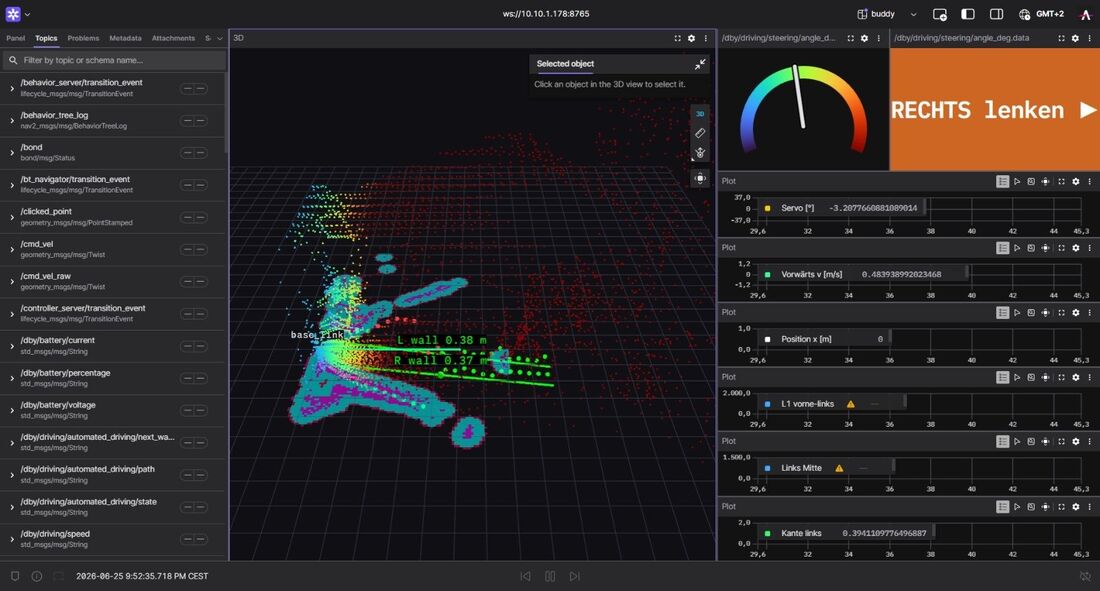
Nav2 mit MPPI-Bahnplanung: Aus Bordsteinkanten, die das 4D-LiDAR erkennt, berechnet DorfBuddy laufend die Mitte des Gehwegs und fährt sie selbstständig ab.

Nav2 with MPPI path planning: from kerb edges detected by the 4D LiDAR, DorfBuddy continuously computes the centre of the footpath and follows it on its own.

Nav2 z planowaniem trasy MPPI: na podstawie krawężników wykrytych przez LiDAR 4D DorfBuddy na bieżąco wyznacza środek chodnika i samodzielnie nim jedzie.

02

KI-Erkennung von Müll & Graffiti

AI Detection of Litter & Graffiti

Rozpoznawanie śmieci i graffiti przez AI

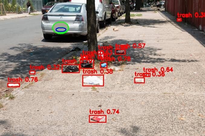
Ein eigens trainiertes YOLOv11-Modell erkennt Müll und Graffiti in rund 8 ms pro Bild – über zwei seitliche Kameras, eine für jede Gehsteigseite.

A custom-trained YOLOv11 model detects litter and graffiti in about 8 ms per image – through two side cameras, one for each side of the sidewalk.

Własnoręcznie wytrenowany model YOLOv11 rozpoznaje śmieci i graffiti w około 8 ms na obraz – za pomocą dwóch bocznych kamer, po jednej na każdą stronę chodnika.

03

Datenschutz an Bord

Privacy on Board

Ochrona danych na pokładzie

Gesichter und Autokennzeichen werden mit Meta EgoBlur direkt auf dem Roboter unkenntlich gemacht – noch bevor ein Bild hochgeladen wird.

Faces and licence plates are blurred with Meta EgoBlur directly on the robot – before any image is uploaded.

Twarze i tablice rejestracyjne są rozmywane przez Meta EgoBlur bezpośrednio na robocie – zanim jakiekolwiek zdjęcie zostanie wysłane.

04

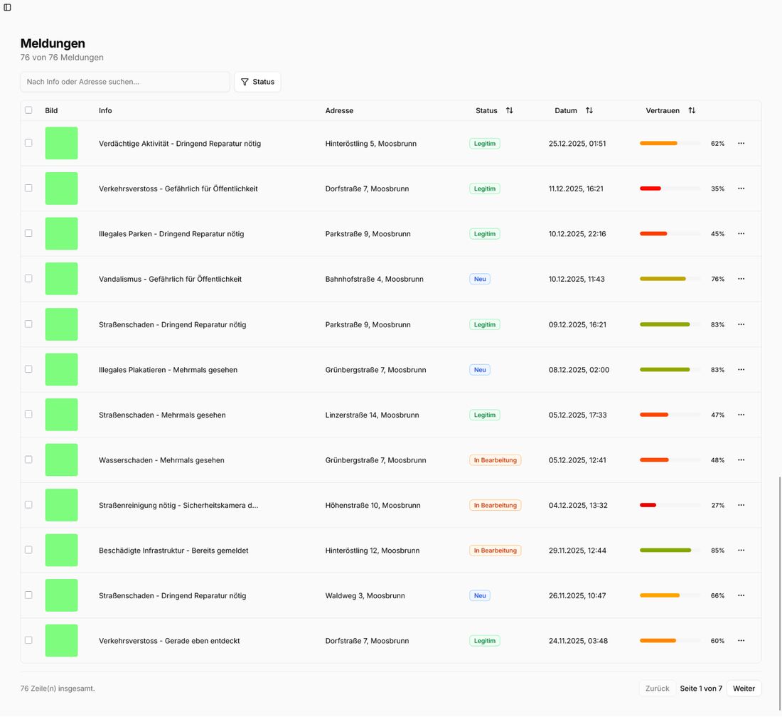
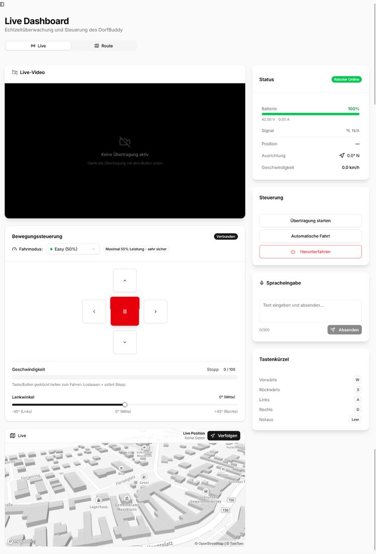
Leitstellen-Dashboard

Control-Room Dashboard

Panel centrum dyspozytorskiego

Web-Oberfläche mit Echtzeit-Karte, Heatmaps der Vandalismus-Hotspots, Routenplanung und Telemetrie – abgesichert mit Rollen und Zwei-Faktor-Login.

Web interface with a live map, vandalism hotspot heatmaps, route planning and telemetry – secured with roles and two-factor login.

Interfejs webowy z mapą na żywo, mapami cieplnymi miejsc wandalizmu, planowaniem tras i telemetrią – zabezpieczony rolami i logowaniem dwuskładnikowym.

05

Sicherheit zuerst

Safety First

Bezpieczeństwo przede wszystkim

Auf Schritttempo (≈ 2 km/h) begrenzt, mehrstufiger Not-Halt mit Totmannschaltung und eine 2D-LiDAR-Notbremse bei Hindernissen unter 30 cm.

Limited to walking pace (≈ 2 km/h), multi-stage emergency stop with dead-man switch and a 2D LiDAR emergency brake for obstacles closer than 30 cm.

Ograniczony do tempa spaceru (≈ 2 km/h), wielostopniowy wyłącznik awaryjny z czuwakiem i hamulec awaryjny z LiDAR 2D przy przeszkodach bliżej niż 30 cm.

06

Ampeln, Licht & Sprache

Traffic Lights, Lights & Voice

Światła, sygnalizacja i głos

Erkennt Fußgängerampeln per YOLOv8, blinkt beim Abbiegen automatisch und warnt Passanten per Sprachausgabe.

Recognises pedestrian lights with YOLOv8, indicates automatically when turning and warns passers-by by voice.

Rozpoznaje sygnalizację dla pieszych za pomocą YOLOv8, sam włącza kierunkowskaz przy skręcie i ostrzega przechodniów komunikatem głosowym.

Vom Alu-Rahmen zum fertigen Roboter

From aluminium frame to finished robot

Od aluminiowej ramy do gotowego robota

Gebaut aus Hoverboard-Teilen, Aluminiumprofilen und rund 341 Stunden 3D-Druck.

Built from hoverboard parts, aluminium profiles and about 341 hours of 3D printing.

Zbudowany z części hoverboardów, profili aluminiowych i około 341 godzin druku 3D.

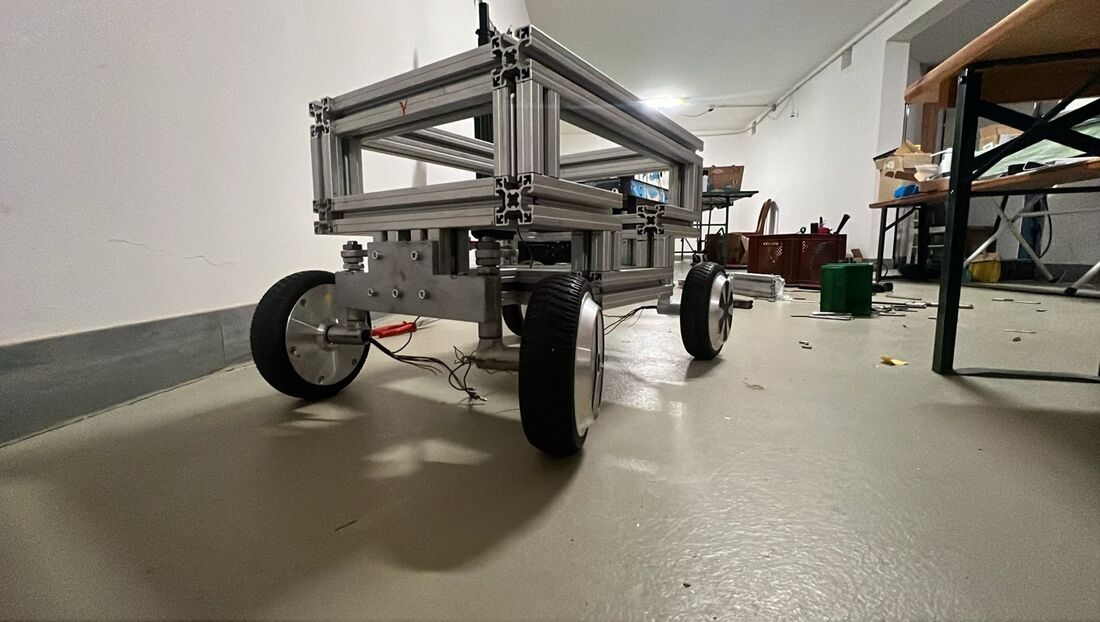
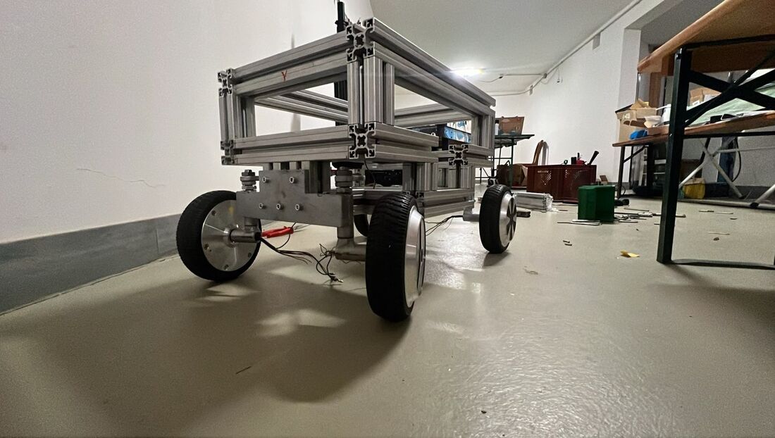
Aluminium-Rahmen mit Nabenmotoren
01

Der Rahmen

The frame

Rama

Aluminiumprofile auf vier 6,5″-Hoverboard-Nabenmotoren, Akku und Elektronik tief und mittig.

Aluminium profiles on four 6.5″ hoverboard hub motors, battery and electronics low and central.

Profile aluminiowe na czterech silnikach w piastach 6,5″ z hoverboardów, akumulator i elektronika nisko i centralnie.

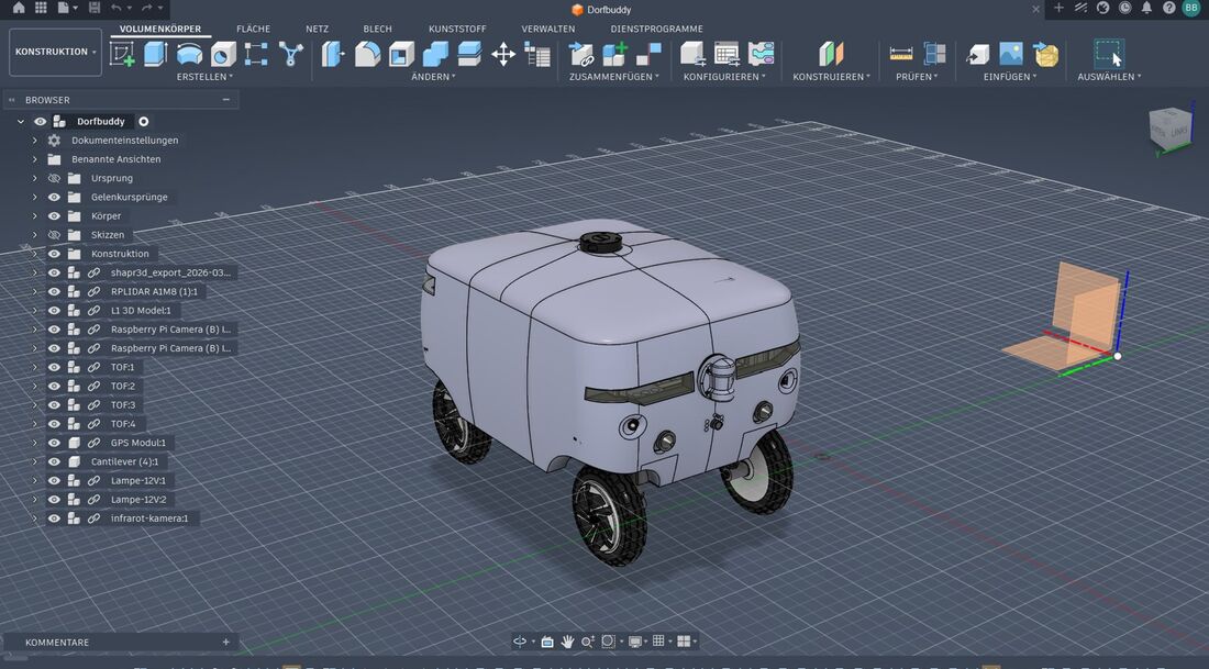
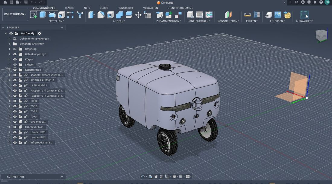
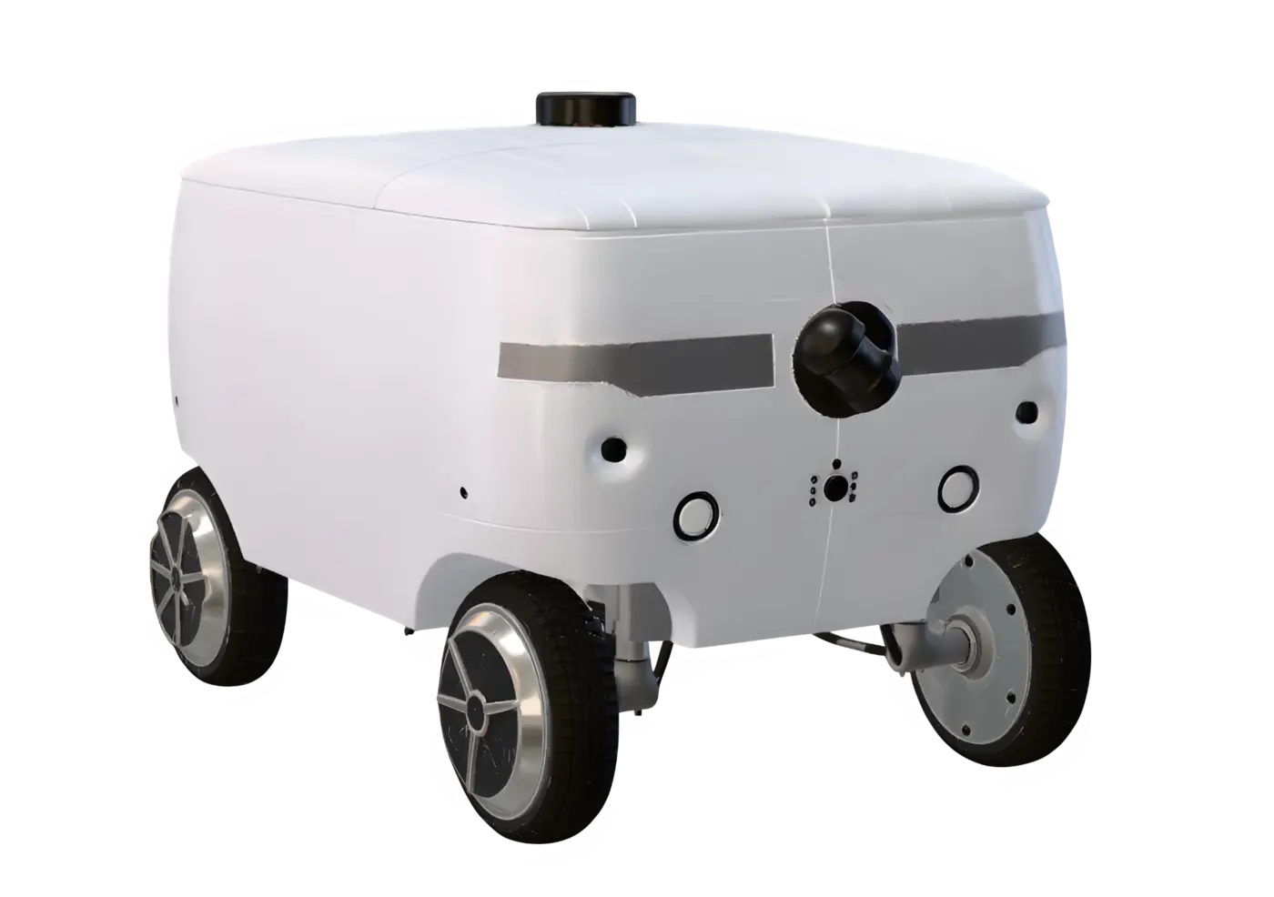
CAD-Modell des Gehäuses in Fusion 360
02

Das Gehäuse

The housing

Obudowa

In Fusion 360 konstruiert und aus UV- und wetterfestem ASA gedruckt – modular gesteckt.

Designed in Fusion 360 and printed in UV- and weather-resistant ASA – modular and plug-together.

Zaprojektowana w Fusion 360 i wydrukowana z odpornego na UV i warunki atmosferyczne ASA – modułowa i składana.

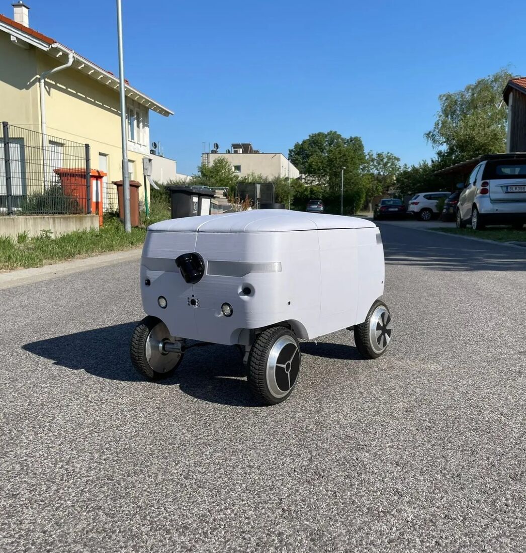
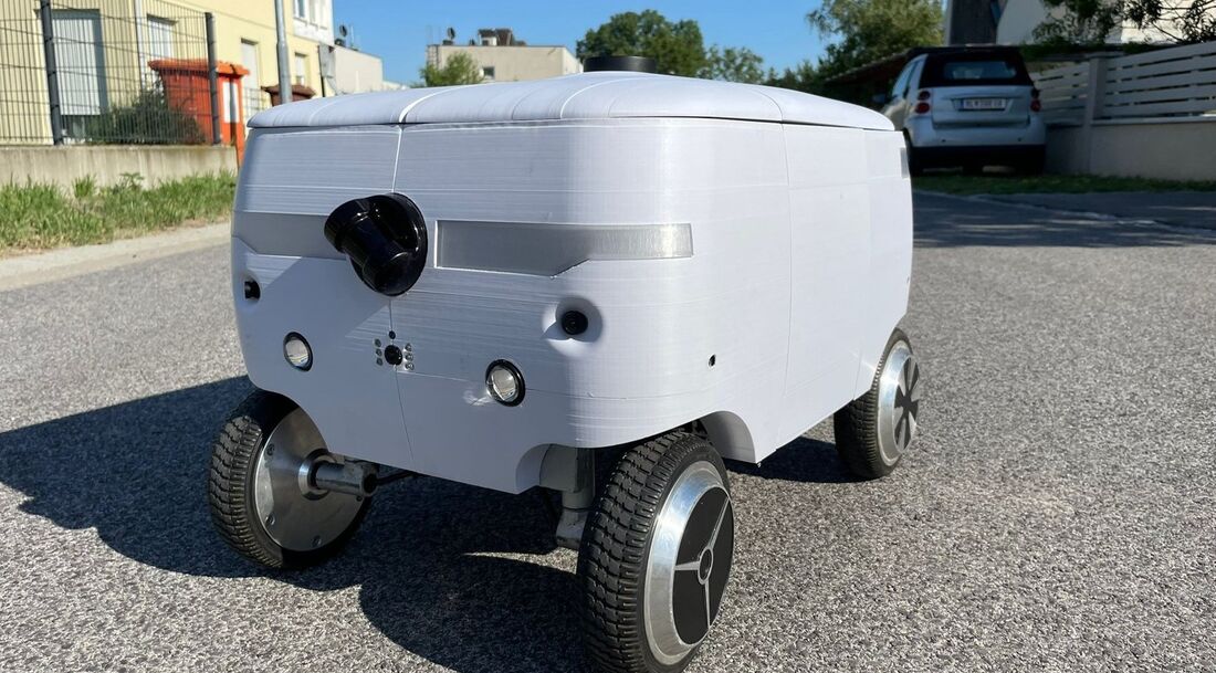
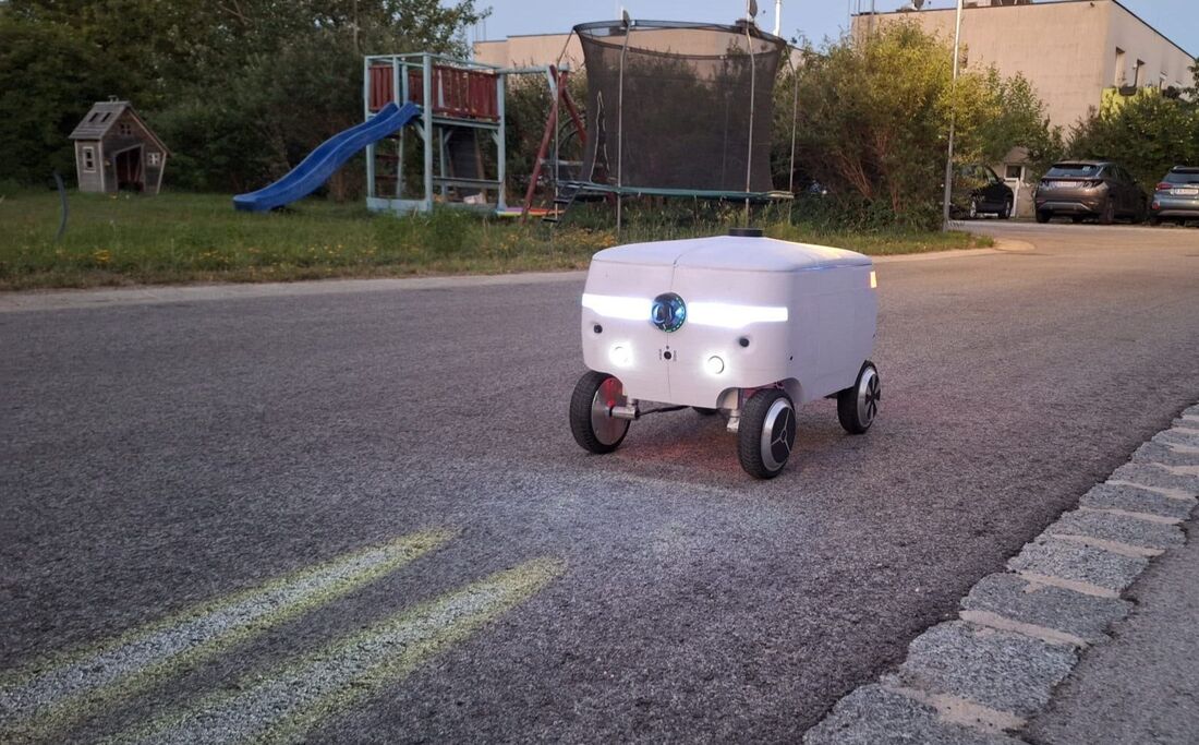
Der fertige DorfBuddy auf der Straße
03

Unterwegs in Moosbrunn

Out in Moosbrunn

W drodze w Moosbrunn

Der fertige Prototyp im Realbetrieb – auf Gehwegen, an Bordsteinen und in direkter Sonne.

The finished prototype in real operation – on sidewalks, along kerbs and in direct sunlight.

Gotowy prototyp w realnym działaniu – na chodnikach, przy krawężnikach i w pełnym słońcu.

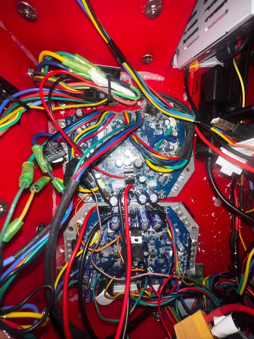
Vier 36-V-Hoverboard-Motoren treiben alle Räder an, vorne lenkt eine echte Ackermann-Lenkung mit Servo. Gerechnet wird auf einem NVIDIA Jetson Orin Nano Super mit ROS2 Humble. Zur Umgebungserfassung dienen ein Unitree L1 4D-LiDAR, ein 2D-RPLidar, vier seitliche Laser-Abstandssensoren, ein L1/L5-GNSS-Empfänger und zwei Kameras mit Infrarot-Nachtsicht. Strom liefert ein 10S-Lithium-Ionen-Akku mit 3,7 kWh.

Four 36 V hoverboard motors drive all wheels, and real servo-based Ackermann steering turns the front axle. Computing runs on an NVIDIA Jetson Orin Nano Super with ROS2 Humble. The surroundings are sensed by a Unitree L1 4D LiDAR, a 2D RPLidar, four side laser distance sensors, an L1/L5 GNSS receiver and two cameras with infrared night vision. Power comes from a 10S lithium-ion battery with 3.7 kWh.

Cztery silniki hoverboardowe 36 V napędzają wszystkie koła, a przednią oś skręca prawdziwy układ Ackermanna z serwem. Obliczenia wykonuje NVIDIA Jetson Orin Nano Super z ROS2 Humble. Otoczenie rejestrują LiDAR 4D Unitree L1, LiDAR 2D RPLidar, cztery boczne laserowe czujniki odległości, odbiornik GNSS L1/L5 i dwie kamery z noktowizją na podczerwień. Zasilanie zapewnia akumulator litowo-jonowy 10S o pojemności 3,7 kWh.

Klein, langsam, ausdauernd

Small, slow, enduring

Mały, powolny, wytrzymały

56 × 42
cm Grundfläche – passt auf jeden Gehweg
cm footprint – fits on any sidewalk
cm podstawy – mieści się na każdym chodniku
≈ 2
km/h – hart auf Schritttempo begrenzt
km/h – hard-limited to walking pace
km/h – twardo ograniczone do tempa spaceru
35
kg mit Gehäuse und Allradantrieb
kg with housing and all-wheel drive
kg z obudową i napędem na cztery koła
≈ 3
Stunden Betrieb pro Akkuladung unter starker Last
hours of operation per charge under heavy load
godziny pracy na jednym ładowaniu przy dużym obciążeniu
Auszeichnung
Award
Wyróżnienie
Top 3 beim ADV DataXcellence Award 2026
Top 3 at the ADV DataXcellence Award 2026
Top 3 w ADV DataXcellence Award 2026

Vier Diplomarbeiten, ein Roboter

Four theses, one robot

Cztery prace dyplomowe, jeden robot

HTL Spengergasse · Abteilung Informatik · 5/6CAIF · Betreuer: Fitzgerald Rodas Reyna

HTL Spengergasse · Department of Information Technology · 5/6CAIF · Supervisor: Fitzgerald Rodas Reyna

HTL Spengergasse · Wydział Informatyki · 5/6CAIF · Opiekun: Fitzgerald Rodas Reyna

Navigation & Kollisionsvermeidung Navigation & Collision Avoidance Nawigacja i unikanie kolizji

Georg Schönbacher

Entwicklung einer autonomen Ausweich- und Positionssteuerung inklusive Seitenabstandsmessung zur sicheren Fahrzeugnavigation.

Development of an autonomous avoidance and position control system including side-distance measurement for safe vehicle navigation.

Opracowanie autonomicznego systemu omijania przeszkód i sterowania pozycją wraz z pomiarem odległości bocznej dla bezpiecznej nawigacji pojazdu.

Forschungsfrage Research question Pytanie badawcze Mit welcher Kombination aus Sensorik, Sensorfusion und Steuerungsalgorithmen lässt sich ein schmales Sidewalk-Fahrzeug so steuern, dass es zuverlässig Abstand hält, Hindernissen ausweicht und sicher navigiert? Which combination of sensors, sensor fusion and control algorithms makes a narrow sidewalk vehicle reliably keep its distance, avoid obstacles and navigate safely? Jakie połączenie czujników, fuzji danych i algorytmów sterowania pozwala tak kierować wąskim pojazdem chodnikowym, by niezawodnie trzymał odstęp, omijał przeszkody i bezpiecznie nawigował?
Laser statt Ultraschall
Seitenabstand Side distance Odległość boczna

Laser statt Ultraschall

Laser instead of ultrasound

Laser zamiast ultradźwięków

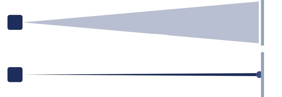
Die ersten Ultraschallsensoren (HC-SR04) streuten in einem Kegel von 15–30° und sprachen sich gegenseitig an. Vier Laser-ToF-Sensoren (VL53L0X/L1X) messen dagegen einen gebündelten Punkt – je zwei links und rechts. Messen vorderer und hinterer Laser gleich viel, steht der Roboter gerade zur Wand.

The first ultrasonic sensors (HC-SR04) spread in a 15–30° cone and interfered with each other. Four laser ToF sensors (VL53L0X/L1X) measure a focused point instead – two on each side. When the front and rear lasers read the same, the robot is parallel to the wall.

Pierwsze czujniki ultradźwiękowe (HC-SR04) rozpraszały sygnał w stożku 15–30° i zakłócały się nawzajem. Cztery laserowe czujniki ToF (VL53L0X/L1X) mierzą natomiast skupiony punkt – po dwa z każdej strony. Gdy przedni i tylny laser pokazują to samo, robot stoi równolegle do ściany.

4×Laser-ToFlaser ToFlaser ToF
940 nmWellenlängewavelengthdługość fali
Ein Kompass aus GPS und Gyroskop
Orientierung Orientation Orientacja

Ein Kompass aus GPS und Gyroskop

A compass from GPS and gyroscope

Kompas z GPS i żyroskopu

Die Motorströme machen ein Magnetometer unbrauchbar. Den Kurs bestimmt deshalb ein Zustandsautomat: Geradeaus zieht GPS das Heading sanft nach, in Kurven übernimmt das Gyroskop, danach wird wieder auf den GPS-Kurs zurückgeführt – ohne Drift.

Motor currents make a magnetometer useless. A state machine therefore determines the heading: going straight, GPS gently corrects it, in turns the gyroscope takes over, and afterwards it is brought back to the GPS course – without drift.

Prądy silników czynią magnetometr bezużytecznym. Kurs wyznacza więc automat stanów: na prostej GPS delikatnie koryguje kierunek, w zakrętach przejmuje żyroskop, a potem kurs wraca do wskazań GPS – bez dryfu.

3Zuständestatesstany
L1/L5GNSSGNSSGNSS
Vom Tiefenbild zum 4D-LiDAR
Sensorwahl & Ergebnis Sensor choice & result Wybór czujników i wynik

Vom Tiefenbild zum 4D-LiDAR

From depth camera to 4D LiDAR

Od kamery głębi do LiDAR 4D

Im Freien überstrahlte Sonnenlicht das Infrarotmuster der Tiefenkamera. Das Unitree L1 4D-LiDAR erkennt Wand und Bordstein auch in direkter Sonne bis 30 m. Nav2 mit MPPI-Regler plant daraus den Weg und weicht aus. Die Ampelerkennung mit YOLOv8n erreicht eine Precision von 0,90.

Outdoors, sunlight washed out the depth camera's infrared pattern. The Unitree L1 4D LiDAR detects walls and kerbs even in direct sun up to 30 m. Nav2 with the MPPI controller plans the path from it and avoids obstacles. Traffic-light detection with YOLOv8n reaches a precision of 0.90.

Na zewnątrz światło słoneczne zagłuszało wzór podczerwieni kamery głębi. LiDAR 4D Unitree L1 rozpoznaje ściany i krawężniki nawet w pełnym słońcu do 30 m. Nav2 z regulatorem MPPI planuje na tej podstawie trasę i omija przeszkody. Rozpoznawanie sygnalizacji świetlnej z YOLOv8n osiąga precyzję 0,90.

21.600Punkte/spoints/spunktów/s
0,90Precision Ampeltraffic-light precisionprecyzja – sygnalizacja

Fragen zu DorfBuddy?

Questions about DorfBuddy?

Pytania o DorfBuddy?

Fragen zum Projekt, zur Technik oder zu unseren Ergebnissen – wir freuen uns auf Ihre Nachricht.

Questions about the project, the technology or our results – we look forward to hearing from you.

Pytania o projekt, technologię lub nasze wyniki – chętnie odpowiemy.